


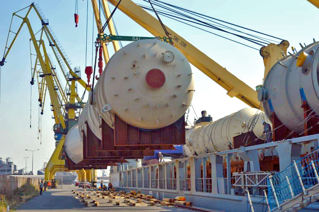
Ship Agency Services
Maria Shipping Agency is providing full agency services in Romanian port Constanta for any type of maritime vessels and river barges.
Get one step ahead your competitors and entrust us with your shipping & logistics needs wherever your goods are moving and no matter what your cargo is.
Frequently Asked Questions
Port limits: As the commercial limits, the port of Constanta is confined by the North and South breakwaters.
Traffic Separation Zone (TSS): The traffic separation scheme for arriving into and departing from the port is as follows:
1. The separation zone has the following limits:
- 44°04.75’N 028°43.77’E
- 44°04.44’N 028°43.22’E
- 43°59.40’N 028°48.60’E
- 43°59.70’N 028°49.17’E
2. The entrance channel into the port has the general direction NW, True course is 322°
- 44°00.19’N 028°50.04’E
- 44°05.24’N 028°44.65’E
3. The departure channel from the port has the general direction SE, True course is 142°
- 44°03.96’N 028°42.35’E
- 43°58.90’N 028°47.74’E
The observance of 1972 COLREG is compulsory. The length of the navigational channel is 6.4 Nm, depth is 21 m. The breadth of the navigational channel is 0.8 Nm.
The width of the separation zone is 0.5 Nm.
Pilotage: Compulsory for all vessels, except navy vessels, vessels used in public service, vessel for maintenance or for the control and surveillance of navigation, intervention vessels, training, hospital and pleasure vessels. Pilotage is compulsory for berthing, unberthing, shifting and is available 24 hours/day.
The vessel’s Master has to contact Constanta VTS / VHF Ch 67 at the entrance into the jurisdiction zone (12 Nm radius from position: 44°10.20’N 028°39.60’E).
Pilot can be contacted in VHF Ch 14. The language used is English. The compulsory zone for embarking/disembarking of pilot is:
* In fair weather (the wind force up to 4): within the circle with a radius of 0.5 Nm from position: 44°05.06’N 028°43.06’E.
* In bad weather (over force 4) near the position 44°06.24’N 028°42.30’E.
Density: 1014
Weather: Prevailing winds: beginning with October and all winter, there are strong northerly winds (up to 9 to 10 Beaufort).
In the summer time, variable winds, sometimes rainfalls.
Maritime signaling system: The Romanian maritime ports are provided with a modern maritime signaling system: light buoys and radar reflectors.
Navigation reference points:
| Location Port Constantza | Characteristics | Range(nm) | Structure/Height (m) |
| Constantza Main Light 44°09′.5N 028°37′.9E |
FI (2) W 29 8s | 24 | White pyramidal concrete tower with blue cupola (58) |
| Light NE Breakwater 44°08’6N 028°40’5E |
FI W 4 5s | 10 | Grey granite tower (18) |
Charts: BA 2284. Admiralty Pilot NP19
The traffic plans: The master of the vessel is obliged to be in permanent contact with Constanta VTS (VHF Ch 67), starting from the vessel’s entrance into the jurisdiction zone,
at anchor also. Entering/leaving in/from the port and also the manoeuvres inside the anchorage zone will be made with the approval of the Constantza VTS only.
Radar: Radar surveillance is permanently performed by Constantza VTS on 12 Nm radius area.
Restrictions: Tug assistance is compulsory for any vessel over 1,000 NRT.
Search and rescue (SAR): In the Romanian ports zone on the Black Sea the SAR operations are provided by ARSVOM (Romanian Association for the rescue
of human life at sea – Constantza), with two tugs: ”Hercules” (6.600 hp) and ”Viteazul” (2.400 hp), and also, 11 SAR launches.
Contact details: AGENTIA ROMANA DE SALVARE A VIETII OMENESTI PE MARE CONSTANTA
- Tel: +40.241.672728, +40.341.488226, +40.341.488227
- Fax: +40.241.616111
- Mail: arsvom@intersat-telecom.ro
Anchorage: The roadstead of Constanta is limited by the following co-ordinates:
- (A) 44°10.50’N 028°44.00’E
- (B) 44°10.50’N 028°49.50’E
- (C) 44°06.50’N 028°49.50’E
- (D) 44°06.50’N 028°44.00’E
The meridians of 028°46.7’E and 028°48.2’E divide the anchorage into 3 zones, numbered from West to East:
Zone 1: Anchorage for vessels up to 40,000 GRT (except tankers)
Zone 2: Anchorage for vessels over 40,000 GRT (except tankers)
Zone 3: Anchorage for tankers, LPG carriers and vessels carying dangerous cargoes
The roadstead allows safe anchorage, with depths of 25-30m for 40 to 50 large ships, with the possibility to make a full swing in case of change of wind or current
direction. In bad weather, small vessels may enter the port waters with the approval of the Constantza VTS only.
Tide: Tidal variations are insignificant. In case of strong and persistent winds, high tide may be 0.5 m above the reference. The drifts direction is from North to South at a speed of more or less 1 knot.
- 1st and 2nd of January (New Year’s days )
- 24 January ( Day of Union of Romanian Principalities )
- 16 of April and 17 of April ( Easter holidays )
- 1st of May (Labor Day )
- 1st of June ( Children’s day )
- 4 and 5 of June ( Whit Sunday and Monday )
- 15th of August ( St. Mary’s Day)
- 30th of November ( St. Andrew’s Day )
- 1st of December ( Great Union Day)
- 25th and 26th of December( Christmas holidays)
To send 72 hours Prior Vessel’s arrival to e-mail address: office@mariashipping.ro
- templates Crew
- templates DPG
- templates Health
- templates Others
- templates Passengers
- templates Port
- templates PSC
- templates Security
- templates Ship
- templates ShipStores
- templates Voyage
- templates Waste
- agency appointment; DOWNLOAD AGENCY APPOINTMENT
- statement of liability; DOWNLOAD STATEMENT OF LIABILITY